1906 Valparaíso earthquake
 Epicentral location | |
| UTC time | 1906-08-17 00:40:04 |
|---|---|
| ISC event | 16957911 |
| USGS-ANSS | ComCat |
| Local date | August 16, 1906 |
| Local time | 19:55 |
| Magnitude | 8.2 Mw[1] |
| Depth | 25 km (16 mi) |
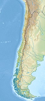
| Epicenter | 32°24′S 71°24′W / 32.400°S 71.400°W[2] |
| Areas affected | Chile |
| Max. intensity | MMI XI (Extreme)[3] |
| Tsunami | Yes |
| Casualties | 3,882 dead[1] |
The 1906 Valparaíso earthquake hit Valparaíso, Chile, on August 16 at 19:55 local time. Its epicenter was offshore from the Valparaíso Region, and its intensity was estimated at magnitude 8.2 Mw.[2] This earthquake occurred thirty minutes after the 1906 Aleutian Islands earthquake.
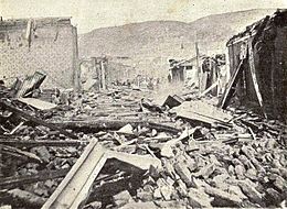
Much of Valparaíso was destroyed; there was severe damage in central Chile from Illapel to Talca. The earthquake was felt from Tacna to Puerto Montt. Reports said the earthquake lasted four minutes. A tsunami was also generated. The earthquake killed a reported 3,882 people.
The record of previous seismic activity includes major earthquakes in 1647, 1730 and 1822.[4] The 1906 disaster was predicted by Captain Arturo Middleton, Chief of the Chilean Army Meteorological Office, in a letter that was published in El Mercurio, one week before it occurred.
Admiral Luis Gómez Carreño ordered the shooting of at least 15 people, who were caught looting after the earthquake.[5] A Board for Reconstruction was formed some weeks after the earthquake. The Seismological Service of Chile was also created.
Background[edit]
Chile lies above a convergent plate boundary, an area where the Nazca Plate under the Pacific Ocean is subducted or moved beneath the South American Plate. In the region around Valparaiso, the rate of convergence is about 70 mm/yr.[6] As these two plates converge, it drives the Nazca plate with massive movements called megathrust earthquakes. The 1906 event was one of many large earthquakes in Chile along this plate boundary. Earthquakes can originate at the plate interface itself or within either the subducting or overriding plates.[citation needed]
Citing the conjunction of Neptune with the moon,[7] Captain Arturo Middleton, Chief of the Chilean Army's Meteorological Office, predicted the earthquake in a letter published in the Valparaíso newspaper El Mercurio on August 6.[8] Captain Middleton was severely criticized in the following days, and was described as "ignorant and obscurantist."[8]
Earthquake characteristics[edit]
On August 16, 1906, at 19:55 local time,[9] while most Chileans were dining, a subterraneous sound was heard, and before it ended, the first tremor occurred, lasting about four minutes.[1] The second tremor occurred at 20:06 and, although it lasted only two minutes, was much more violent.[10] There were numerous aftershocks: at least 56 of them occurred during the first 24 hours after the beginning tremors.[9]
The magnitude of the earthquake has been estimated to be 8.4 ML, 8.2 Mw[11] or Ms 8.2–8.3. The energy release has been re-evaluated with an estimated seismic moment of 2.8 x 1028, equivalent to a magnitude of 8.26 Mw . The rupture length of the earthquake has been estimated at about 200 km with a focal depth of about 40 km.[12] The focal mechanism has been assessed using contemporary seismograph records from five stations, which were published soon after the earthquake. The data suggest that the earthquake was probably along the subduction interface. Modelling of a tsunami using these source parameters shows that this earthquake was the origin of the transpacific tsunamis recorded that same day in Hawaii and Japan, rather than the almost contemporaneous 1906 Aleutian Islands earthquake.[12]
The 30-minute time gap between the Aleutian and Chilean earthquakes is thought to be coincidental, with no causal link between the two.[12]
Damage[edit]

The earthquake caused damage throughout Central Chile, from Illapel to Talca.[1] There were several destructive fires in El Almendral (from Plaza de la Victoria to Cerro Barón), Mercado Cardonal, Teatro de la Victoria (Victory Theatre), the Intendencia, the Maritime Government in Sotomayor Square and the Fiscal Dock at the port.[13]
The earthquake was also felt in Santiago, the capital of Chile. The newspaper El Mercurio reported in its August 17 edition that "the earthquake was produced in a violent way since its beginning, and provoked an indescribable panic through all the four thousands of inhabitants of Santiago and an unprecedented terror in the last years. Two or three-story buildings, even the most solid ones such as the National Congress, were swinging like a vessel in the sea. The shakings were so strong that many people thought the earth was going to open itself in deep and long strips."[14]
According to the University of Chile, there were 3,882 deaths.[1] The earthquake left more than 20,000 injured.[13]
On August 19, Admiral Luis Gómez Carreño was appointed Plaza Port Chief. Gómez ordered the distribution of water and food, removal of corpses and demolition of buildings in risk of collapse, from a tent in Plaza de La Victoria.[5] Adm. Gómez ordered the shooting of at least 15 people who had committed crimes during the aftermath.[5]
-
Teatro de la Victoria before the earthquake
-
Teatro de la Victoria after the earthquake
-
Looters shot by the authorities.
Relief efforts[edit]
Despite the state of the city, authorities quickly organized themselves into relief groups. Firefighters from other cities of Chile, including Santiago, Concepción and Talcahuano, moved to Valparaíso to help the local Fire Bureau.[15] Physician José Grossi worked to counteract the plagues that followed the earthquake.[10][16]
On August 25, President Germán Riesco and President-Elect Pedro Montt arrived at Valparaíso. They arrived there by train, on foot, or horseback to survey the magnitude of the disaster.[14]
Some weeks after the earthquake, a Board for Reconstruction was formed, using money received from other countries.[5]
Aftermath[edit]
In 1906, the Seismological Service of Chile (Servicio Sismológico de Chile) was created. Its first chief executive was Fernand de Montessus de Ballore.[17]
The effects of this historic seismic event in the Valparaíso rupture zone would be studied and measurable in the context of further seismic activity in this vicinity.[18]
See also[edit]
Notes[edit]
- ^ a b c d e "Earthquakes with 1,000 or More Deaths since 1900". United States Geological Survey. Archived from the original on January 14, 2013. Retrieved October 11, 2010.
- ^ a b ANSS. "Valparaiso, Chile 1906: M 8.2 – Valparaiso, Chile". Comprehensive Catalog. U.S. Geological Survey. Retrieved August 16, 2018.
- ^ National Geophysical Data Center / World Data Service (NGDC/WDS) (1972), Significant Earthquake Database (Data Set), National Geophysical Data Center, NOAA, doi:10.7289/V5TD9V7K
- ^ Korrat, I.; Madariaga, R. (1986). "Rupture of the Valparaiso (Chile) Gap from 1971–1985". Earthquake Source Mechanics. American Geophysical Union. p. 251. ISBN 9780875904054.
- ^ a b c d "Gómez Carreño, el "sheriff" que controló Valparaíso en el sismo de 1906" (in Spanish). La Tercera. Archived from the original on July 23, 2011. Retrieved October 11, 2010.
- ^ USGS (October 8, 2010). "Magnitude 8.8 – OFFSHORE MAULE, CHILE". Archived from the original on November 1, 2010. Retrieved October 15, 2010.
- ^ "Materialismo sísmico (y 2)". Revista Sábado (in Spanish). El Mercurio. June 5, 2010. Retrieved October 11, 2010. (subscription required)
- ^ a b "Materialismo sísmico". Revista Sábado (in Spanish). El Mercurio. May 29, 2010. Retrieved October 11, 2010. (subscription required)
- ^ a b "La catástrofe del 16 de agosto de 1906 en Chile" (PDF) (in Spanish). Memoria Chilena. Archived (PDF) from the original on March 16, 2012. Retrieved February 27, 2013.
- ^ a b "Terremoto Valparaíso" (in Spanish). Memoria Chilena. Archived from the original on June 20, 2012. Retrieved October 16, 2010.
- ^ "SISMOS IMPORTANTES Y/O DESTRUCTIVOS (1570 – Mayo 2005)" (in Spanish). Servicio Sismológico de la Universidad de Chile. Archived from the original on December 31, 2006. Retrieved October 11, 2010.
- ^ a b c Okal, E.A. (2005). "A re-evaluation of the great Aleutian and Chilean earthquakes of 1906 August 17". Geophysical Journal International. 161 (2): 268–282. Bibcode:2005GeoJI.161..268O. doi:10.1111/j.1365-246X.2005.02582.x.
- ^ a b "Valparaíso: las tragedias que marcaron su identidad" (in Spanish). Ciudad de Valparaíso. Archived from the original on July 7, 2011. Retrieved October 11, 2010.
- ^ a b "El terremoto del Centenario". Diario el Día. October 11, 2010.
- ^ Ponce, Galvarino. "La jornada del hambre" (in Spanish). Archived from the original on July 7, 2011. Retrieved October 11, 2010.
- ^ "La noche en que Valparaíso se desplomó" (in Spanish). El Mercurio. July 30, 2006. Retrieved October 11, 2010. (subscription required)
- ^ "Fernand de Montessus de Ballore Primer Director del Servicio Sismológico, 1908–1923" (in Spanish). Seismological Service of Chile. 2006. Archived from the original on February 28, 2013. Retrieved October 11, 2010.
- ^ Korrat, (1986). pp. 247–258., p. 247, at Google Books
References[edit]
- Das, Shamita; John Boatwright and C. H. Scholz. (1986). Earthquake Source Mechanics. Washington, D.C.: American Geophysical Union. ISBN 9780875904054; OCLC 13526041
Further reading[edit]
- Rodríguez Rozas, Alfredo; Gajardo Cruzat, Carlos (1906). La catástrofe del 16 de agosto de 1906 en la República de Chile (in Spanish). Santiago, Chile: Imprenta y Litografía Barcelona.
External links[edit]
- Terremoto de 1906 in Valparaíso Fire Bureau's website (archive) (in Spanish)
- The International Seismological Centre has a bibliography and/or authoritative data for this event.


