Al-Khayma
Al-Khayma
الخيمة | |
|---|---|
Village | |
| Etymology: The Tent[1] | |
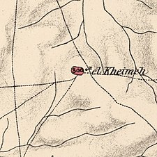
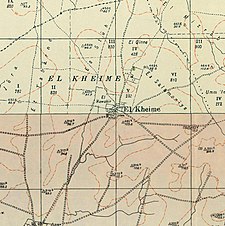
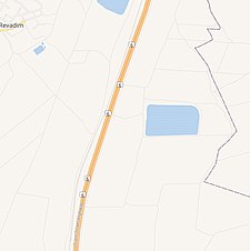
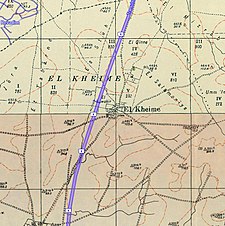
A series of historical maps of the area around Al-Khayma (click the buttons) | |
Location within Mandatory Palestine | |
| Coordinates: 31°45′44″N 34°49′47″E / 31.76222°N 34.82972°E | |
| Palestine grid | 133/130 |
| Geopolitical entity | Mandatory Palestine |
| Subdistrict | Ramle |
| Date of depopulation | Not known[4] |
| Area | |
| • Total | 5,150 dunams (5.15 km2 or 1.99 sq mi) |
| Population (1945) | |
| • Total | 190[2][3] |
Al-Khayma (Arabic: الخيمة) was a Palestinian Arab village in the Ramle Subdistrict of Mandatory Palestine. It was depopulated during the 1948 Arab–Israeli War on July 9, 1948, by the Givati Brigade of Operation An-Far. It was located 18.5 km south of Ramla.
History[edit]
In 1863, Victor Guérin found that it had two hundred and fifty inhabitants.[5]
In 1882, the PEF's Survey of Western Palestine noted it as principally an adobe village of "on low ground", and with a well to the east.[6]
British Mandate era[edit]
In the 1922 census of Palestine, conducted by the British Mandate authorities, Khaimeh had a population of 132 Muslims,[7] increasing in the 1931 census to 141 Muslims, in 30 houses.[8]
In the 1945 statistics, the village had a population of 190, all Muslim,[2] and the total land area was 5,150 dunums.[3] Of this, 4 dunams were irrigated or used for plantations, 5,007 were used for cereals,[9] while 9 dunams were classified as built-up urban areas.[10]
1948 and aftermath[edit]
Morris list both date and reason for depopulation as "not known".[4] However, he also notes it in connection with Operation An-Far, in mid July 1948.[11][12]
Following the 1948 war, the area was incorporated into the State of Israel and in August 1948 al-Khaymas was one of 21 Palestinian villages whose land was proposed for resettlement with an Israeli village named Revadim.[13] In November, 1948, the proposal to establish Revadim on al-Khayma's land was passed.[14]
Revadim was eventually established close to village land, according to Morris,[15] however, according to Khalidi, Revadim is located north of al-Khayma, on the land of the depopulated Palestinian village of al-Mukhayzin.[16]
In 1992 the village site was described: "All that remains of the village are three mounds to the east, west, and south of the site that contain the remnants of houses. A girder protrudes from the eastern mound and there is a large, deserted well at the mounds centre. A large artificial pond lies about 100 m northeast of the site, and there is a monument next to a well about 0.5 km to the north. An inscription on the monument reads: To the eMemory of the Members of Kibbutz Revadim, who Settled on the Land in 1948."[17]
References[edit]
- ^ Palmer, 1881, p. 268
- ^ a b Department of Statistics, 1945, p. 29
- ^ a b c Government of Palestine, Department of Statistics. Village Statistics, April, 1945. Quoted in Hadawi, 1970, p. 67
- ^ a b Morris, 2004, p. xix, village #267. Morris gives both cause and date of depopulation as "Not known".
- ^ Guérin, 1869, p. 88
- ^ Conder and Kitchener, 1882, SWP II, p. 408, cited in Khalidi, 1992, p. 388
- ^ Barron, 1923, Table VII, Sub-district of Ramleh, p. 21
- ^ Mills, 1932, p. 21
- ^ Government of Palestine, Department of Statistics. Village Statistics, April, 1945. Quoted in Hadawi, 1970, p. 115
- ^ Government of Palestine, Department of Statistics. Village Statistics, April, 1945. Quoted in Hadawi, 1970, p. 165
- ^ Morris, 2004, p. 437
- ^ Morris, 2004, p. 443
- ^ Morris, 2004, p. 376
- ^ Morris, 2004, p. 380
- ^ Morris, 2004, p. xxi, settlement #35
- ^ Khalidi, 1992, p. 388
- ^ Khalidi, 1992, pp. 388-389
Bibliography[edit]
- Barron, J.B., ed. (1923). Palestine: Report and General Abstracts of the Census of 1922. Government of Palestine.
- Conder, C.R.; Kitchener, H. H. (1882). The Survey of Western Palestine: Memoirs of the Topography, Orography, Hydrography, and Archaeology. Vol. 2. London: Committee of the Palestine Exploration Fund.
- Department of Statistics (1945). Village Statistics, April, 1945. Government of Palestine.
- Guérin, V. (1869). Description Géographique Historique et Archéologique de la Palestine. Vol. 1: Judee, pt. 2. Paris, L'Imprimerie Imp.
- Hadawi, S. (1970). Village Statistics of 1945: A Classification of Land and Area ownership in Palestine. Palestine Liberation Organization Research Center. Archived from the original on 2018-12-08. Retrieved 2009-08-18.
- Khalidi, W. (1992). All That Remains: The Palestinian Villages Occupied and Depopulated by Israel in 1948. Washington D.C.: Institute for Palestine Studies. ISBN 0-88728-224-5.
- Mills, E., ed. (1932). Census of Palestine 1931. Population of Villages, Towns and Administrative Areas. Jerusalem: Government of Palestine.
- Morris, B. (2004). The Birth of the Palestinian Refugee Problem Revisited. Cambridge University Press. ISBN 978-0-521-00967-6.
- Palmer, E.H. (1881). The Survey of Western Palestine: Arabic and English Name Lists Collected During the Survey by Lieutenants Conder and Kitchener, R. E. Transliterated and Explained by E.H. Palmer. Committee of the Palestine Exploration Fund.
External links[edit]
- Welcome To al-Khayma
- al-Khayma, Zochrot
- Survey of Western Palestine, Map 16: IAA, Wikimedia commons
- al-Khayma, from the Khalil Sakakini Cultural Center


