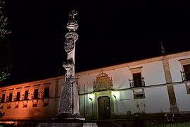
Condeixa-a-Nova
Condeixa-a-Nova | |
|---|---|
 | |
 | |
| Coordinates: 40°07′N 8°30′W / 40.117°N 8.500°W | |
| Country | |
| Region | Centro |
| Intermunic. comm. | Região de Coimbra |
| District | Coimbra |
| Parishes | 7 |
| Area | |
| • Total | 138.67 km2 (53.54 sq mi) |
| Highest elevation | 465 m (1,526 ft) |
| Lowest elevation | 12 m (39 ft) |
| Population (2011) | |
| • Total | 17,078 |
| • Density | 120/km2 (320/sq mi) |
| Time zone | UTC±00:00 (WET) |
| • Summer (DST) | UTC+01:00 (WEST) |
Condeixa-a-Nova (Portuguese pronunciation: [kõˈdɐjʃa ˈnɔvɐ] ⓘ), also known as just Condeixa, is a town and a municipality in the district of Coimbra, Portugal. The population in 2011 was 17,078,[1] in an area of 138.67 km2.[2] It is located 15 km south of Coimbra, and is part of the Região de Coimbra. The town is known for the ancient Roman settlement of Conímbriga which is located nearby, and includes a museum and the well-preserved ruins.
Economy[edit]
The municipality of Condeixa-a-Nova is traditionally a center for agriculture. The municipality has also a number of industries ranging from ceramics to pharmaceuticals (Medinfar). The ancient Roman settlement of Conímbriga, is an important tourist attraction.
Parishes[edit]
Administratively, the municipality is divided into seven civil parishes (freguesias):[3]
- Anobra
- Condeixa-a-Velha e Condeixa-a-Nova
- Ega
- Furadouro
- Sebal e Belide
- Vila Seca e Bem da Fé
- Zambujal
Notable people[edit]
- Antão de Almada (1718 in Condeixa-a-Nova – 1797) the Grand Master of Ceremonies for the Royal House and first Captain-General of the Azores.
- Fernando Namora (1919 in Condeixa-a-Nova – 1989) a Portuguese writer and medical doctor.
References[edit]
- ^ Instituto Nacional de Estatística
- ^ "Áreas das freguesias, concelhos, distritos e país". Archived from the original on 2018-11-05. Retrieved 2018-11-05.
- ^ Diário da República. "Law nr. 11-A/2013, pages 552 41-42" (pdf) (in Portuguese). Retrieved 21 July 2014.
External links[edit]
- Municipality of Condeixa-a-Nova (in Portuguese)
- Photos from Condeixa-a-Nova on Flickr


