
File:Bukhariya1925.png
Size of this preview: 574 × 599 pixels. Other resolutions: 230 × 240 pixels | 460 × 480 pixels | 736 × 768 pixels | 981 × 1,024 pixels | 1,962 × 2,048 pixels | 2,919 × 3,047 pixels.
Original file (2,919 × 3,047 pixels, file size: 844 KB, MIME type: image/png)
| This is a file from the Wikimedia Commons. Information from its description page there is shown below. Commons is a freely licensed media file repository. You can help. |
Summary
| Description |
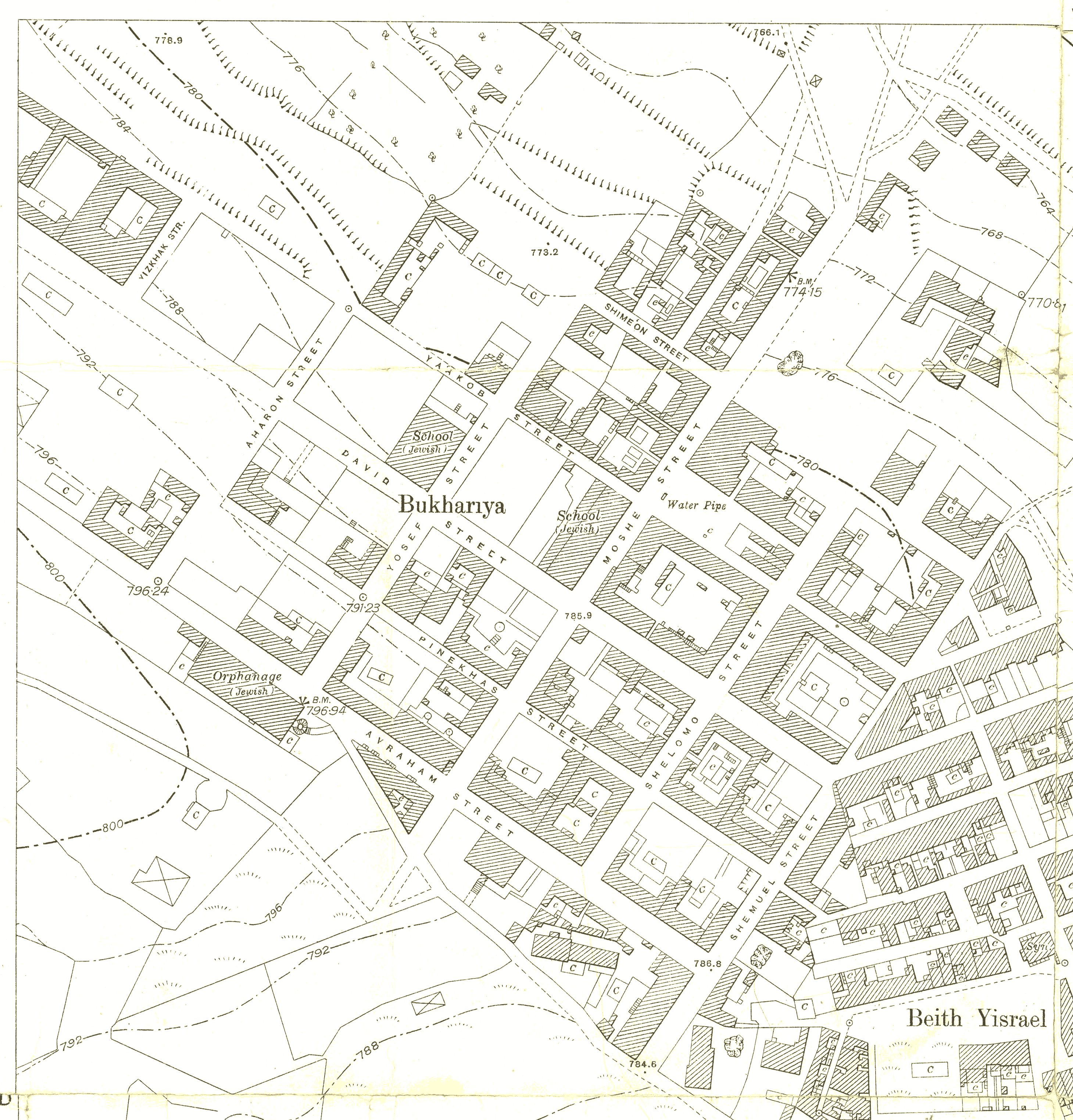
English: This is a portion of the map "Jerusalem, Plan VII-E" revised in January 1925 by the Survey of Palestine based on surveys of 1922. Scale 1:2000. |
| Date | |
| Source | National Library of Israel |
| Author | Survey of Palestine |
Licensing
This work created by the United Kingdom Government is in the public domain.
This is because it is one of the following:
HMSO has declared that the expiry of Crown Copyrights applies worldwide (ref: HMSO Email Reply)
|
 |
File history
Click on a date/time to view the file as it appeared at that time.
| Date/Time | Thumbnail | Dimensions | User | Comment | |
|---|---|---|---|---|---|
| current | 10:40, 9 May 2021 | | 2,919 × 3,047 (844 KB) | Zero0000 | Uploaded a work by Survey of Palestine from National Library of Israel with UploadWizard |
File usage
The following pages on the English Wikipedia use this file (pages on other projects are not listed):
Global file usage
The following other wikis use this file:
- Usage on no.wikipedia.org
- Usage on uz.wikipedia.org