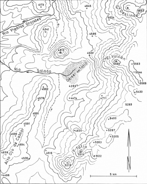
File:El Tatio topography.png

Size of this preview: 481 × 599 pixels. Other resolutions: 193 × 240 pixels | 569 × 709 pixels.
Original file (569 × 709 pixels, file size: 304 KB, MIME type: image/png)
Summary[edit]
| Description |
A topographic map of the El Tatio area |
|---|---|
| Source |
Zeil, Werner (1959). Das Fumarolen- und Geysir-Feld westlich der Vulkangruppe des Tatio (Provinz Antofagasta, Chile). Vorgelegt von Albert Maucher am 4. Juli 1958 (PDF) (in German). Bayerische Akademie der Wissenschaften. Retrieved 29 November 2017. |
| Date |
4 July 1958 |
| Author |
Werner Zeil |
| Permission (Reusing this file) |
See below.
|
Licensing[edit]
| This work is licensed under the Creative Commons Attribution 4.0 License. |
File history
Click on a date/time to view the file as it appeared at that time.
| Date/Time | Thumbnail | Dimensions | User | Comment | |
|---|---|---|---|---|---|
| current | 08:20, 1 October 2021 |  | 569 × 709 (304 KB) | Jo-Jo Eumerus (talk | contribs) | {{Information | description = A topographic map of the El Tatio area | source = {{cite book|last1=Zeil|first1=Werner|title=Das Fumarolen- und Geysir-Feld westlich der Vulkangruppe des Tatio (Provinz Antofagasta, Chile). Vorgelegt von Albert Maucher am 4. Juli 1958|date=1959|publisher=Bayerische Akademie der Wissenschaften|url=http://publikationen.badw.de/de/meta/003071425|access-date=29 November 2017|language=de|format=PDF}} | date = 4 July 1958 | author = Werner Zeil }} |
You cannot overwrite this file.
File usage
The following pages on the English Wikipedia use this file (pages on other projects are not listed):
