
File:Height 743 section Jerusalem map, scale 10,000 scale, 1st edition, Survey of Palestine, Jaffa, August 1925, Ordnance Survey Offices, Southhampton, 1926.png
Size of this preview: 527 × 599 pixels. Other resolutions: 211 × 240 pixels | 422 × 480 pixels | 717 × 815 pixels.
Original file (717 × 815 pixels, file size: 977 KB, MIME type: image/png)
| This is a file from the Wikimedia Commons. Information from its description page there is shown below. Commons is a freely licensed media file repository. You can help. |
Summary
| Description |
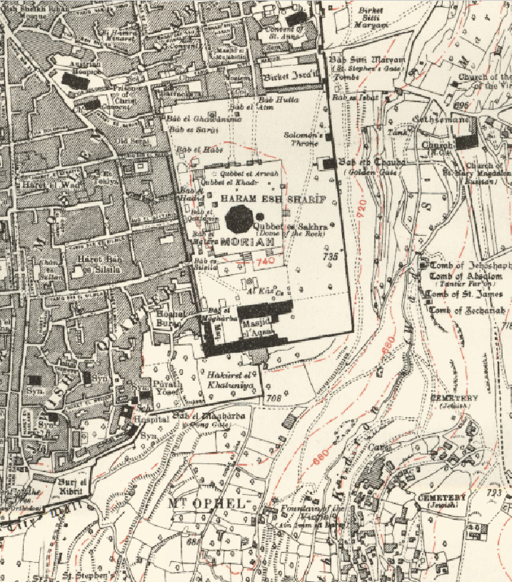
English: Height 743 section of Jerusalem map (1925) showing location of Mount Zion according to Jewish sources, also known as Mount Moriah. |
| Date | |
| Source | Jerusalem map, scale 1:10,000 1st edition, Survey of Palestine, Jaffa, August 1925, Ordnance Survey Offices, Southhampton, 1926. |
| Author | Ordnance Survey Offices, Southhampton, 1926 |
Licensing
| This file is made available under the Creative Commons CC0 1.0 Universal Public Domain Dedication. | |
| The person who associated a work with this deed has dedicated the work to the public domain by waiving all of their rights to the work worldwide under copyright law, including all related and neighboring rights, to the extent allowed by law. You can copy, modify, distribute and perform the work, even for commercial purposes, all without asking permission.
|
File history
Click on a date/time to view the file as it appeared at that time.
| Date/Time | Thumbnail | Dimensions | User | Comment | |
|---|---|---|---|---|---|
| current | 05:33, 12 October 2016 | | 717 × 815 (977 KB) | Crock81 | User created page with UploadWizard |
File usage
The following pages on the English Wikipedia use this file (pages on other projects are not listed):
Global file usage
The following other wikis use this file:
- Usage on ar.wikipedia.org
- Usage on arz.wikipedia.org
- Usage on el.wikipedia.org
- Usage on eo.wikipedia.org
- Usage on es.wikipedia.org
- Usage on fi.wikipedia.org
- Usage on ru.wikipedia.org
- Usage on www.wikidata.org