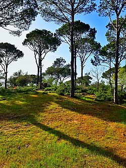
Jezzine District
Jezzine District | |
|---|---|
District | |
 Jezzine District | |
 Location in Lebanon | |
| Country | |
| Governorate | South Governorate |
| Capital | Jezzine |
| Area | |
| • Total | 93 sq mi (241 km2) |
| Population | |
| • Estimate (31 December 2017) | 31,575 |
| Time zone | UTC+2 (EET) |
| • Summer (DST) | UTC+3 (EEST) |
The Jezzine District (Arabic: قضاء جزين) is a district in the South Governorate of Lebanon. The capital is Jezzine.
76% of registered voters (59642) in the district are Christians. Of those, 60% are Maronite, 14% Greek Melkite Catholic, and the rest are minorities (Armenian Catholic, Eastern Orthodox, Evangelic, Protestants, etc...). The remaining 24% are Druze, Shiite (mainly), and Sunni voters, respectively.[2] This distinguishes the district from the rest of Southern Lebanon, which is approximately 90% Muslim. Some notable towns other than its capital Jezzine include Kfarhouna, Aichiyé, Bkassine, Kfar Falous, Jernaya and Homsiyé.
Gallery[edit]
References[edit]
- ^ Brinkhoff, Thomas (2 March 2019). "Lebanon: Administrative Division". City Population. Retrieved 3 July 2021.
- ^ https://elections.lebanese-forces.com/wp-content/uploads/2018/02/JEZZINE-SAIDA-1.pdf [bare URL PDF]


