Khirbat al-Muntar
Khirbat al-Muntar
خربة المُنطار | |
|---|---|
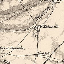
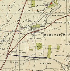
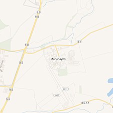
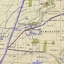
A series of historical maps of the area around Khirbat al-Muntar (click the buttons) | |
Location within Mandatory Palestine | |
| Coordinates: 32°59′21″N 35°34′13″E / 32.98917°N 35.57028°E | |
| Palestine grid | 205/265 |
| Geopolitical entity | Mandatory Palestine |
| Subdistrict | Safad |
Khirbat al-Muntar was a Palestinian Arab village in the Safad Subdistrict. It was depopulated during the 1948 Arab-Israeli War by Palmach's First Battalion and 'Oded Brigade of Operation Yiftach after resistance by the Syrian Army. It was located 8.5 km east of Safad.
History[edit]
In 1838, Edward Robinson noted al-Muntar as an encampment of Turkish and Kurdish nomads.[1]
At the end of the 19th century, much of the land was purchased by Baron Rothschild, and Mahanayim was established in 1898 on former Khirbat al-Muntar land. Mahanayim failed and was abandoned, but reestablished in 1939.[2]
In the 1945 statistics, during the British Mandate of Palestine, Khirbat al-Muntar was counted under Mahanayim, and Arabs owned only 52 dunams out of a total of 2,472 dunums of land.[3][4] All of the 52 dunums were for used cereals.[5][6]
References[edit]
- ^ Robinson and Smith, 1841, vol 3, p. 362, cited in Khalidi, 1992, p. 480
- ^ Khalidi, 1992, p. 480
- ^ Department of Statistics, 1945, p. 10
- ^ Government of Palestine, Department of Statistics. Village Statistics, April, 1945. Quoted in Hadawi, 1970, p. 70
- ^ Government of Palestine, Department of Statistics. Village Statistics, April, 1945. Quoted in Hadawi, 1970, p. 119
- ^ Government of Palestine, Department of Statistics. Village Statistics, April, 1945. Quoted in Hadawi, 1970, p. 169
Bibliography[edit]
- Department of Statistics (1945). Village Statistics, April, 1945. Government of Palestine.
- Hadawi, S. (1970). Village Statistics of 1945: A Classification of Land and Area ownership in Palestine. Palestine Liberation Organization Research Center.
- Khalidi, W. (1992). All That Remains:The Palestinian Villages Occupied and Depopulated by Israel in 1948. Washington D.C.: Institute for Palestine Studies. ISBN 0-88728-224-5.
- Morris, B. (2004). The Birth of the Palestinian Refugee Problem Revisited. Cambridge University Press. ISBN 978-0-521-00967-6.
- Robinson, E.; Smith, E. (1841). Biblical Researches in Palestine, Mount Sinai and Arabia Petraea: A Journal of Travels in the year 1838. Vol. 3. Boston: Crocker & Brewster.
External links[edit]
- Welcome To al-Muntar, Khirbat
- Khirbat al-Muntar, Villages of Palestine.
- Khirbat al-Muntar, Zochrot
- Survey of Western Palestine, Map 4: IAA, Wikimedia commons


