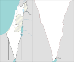
Lotan, Israel
Lotan
לוטן لوتان | |
|---|---|
 | |
| Coordinates: 29°59′8″N 35°5′18″E / 29.98556°N 35.08833°E | |
| Country | Israel |
| District | Southern |
| Council | Hevel Eilot |
| Affiliation | Kibbutz Movement |
| Founded | 1983 |
| Founded by | Reform Movement |
| Population (2022)[1] | 200 |


Kibbutz Lotan (Hebrew: לוֹטָן) is a Reform kibbutz in southern Israel. Located in the Arabah Valley in the Negev desert, it falls under the jurisdiction of Hevel Eilot Regional Council. In 2022 it had a population of 200.[1] The kibbutz is a member of the Israel Movement for Reform and Progressive Judaism and the Global Ecovillage Network.
History[edit]
The kibbutz was founded in 1983 by idealistic Israeli and American youths who together built a profit sharing community based on pluralistic, egalitarian and creative Jewish values while protecting the environment. The name of the kibbutz derives from "one of the sons of Seir the Horite".[2] (Genesis 36:20; a descendant of Esau, who lived in Edom nearby).
Economy[edit]
Income is generated by growing Medjool and Dekel Noir dates, dairy cows for milk and goats for cheese production, member's incomes from work throughout the region and ecotourism including birdwatching and holistic health – in particular watsu – water shiatsu – treatments and courses.
The kibbutz's Center for Creative Ecology is an environmental education, research and conservation institution. The Center offers academic programs in conjunction with the University of Massachusetts Amherst and certification courses in permaculture, sustainable design and training. Facilities include an interactive park for organic and urban agriculture, natural building and solar energy demonstrations as well as the energy-efficient EcoCampus, a neighborhood constructed from earth-plastered straw bales.
References[edit]
- ^ a b "Regional Statistics". Israel Central Bureau of Statistics. Retrieved 21 March 2024.
- ^ Carta's Official Guide to Israel and Complete Gazetteer to all Sites in the Holy Land. (3rd edition 1993) Jerusalem, Carta, p.299, ISBN 965-220-186-3 (English) and Bitan, Hanna: 1948-1998: Fifty Years of 'Hityashvut': Atlas of Names of Settlements in Israel, Jerusalem 1999, Carta, p.36, ISBN 965-220-423-4 (in Hebrew)

