Nabatieh Governorate
Nabatieh
محافظة النبطية | |
|---|---|
 Map of Lebanon with Nabatieh highlighted | |
| Coordinates: 33°18′N 35°30′E / 33.300°N 35.500°E | |
| Country | Lebanon |
| Capital | Nabatieh |
| Government | |
| • Governor | Mahmoud Al-Mawla |
| Area | |
| • Total | 1,058 km2 (408 sq mi) |
| Population | |
| • Estimate (31 December 2017)[1] | 383,839 |
| Time zone | UTC+2 (EET) |
| • Summer (DST) | UTC+3 (EEST) |
Nabatieh Governorate (Arabic: محافظة النبطية, Muḥāfaẓat an-Nabaṭiyyah) is one of the nine governorates of Lebanon. The area of this governorate is 1,058 km2. The capital is Nabatieh.
Districts[edit]
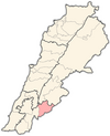
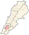
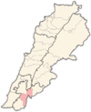
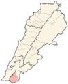
The governorate is divided into four districts (Aqdiya, singular qadaa) containing 116 municipalities. The capitals are in brackets:
- Bint Jbeil (Bint Jbeil) – 36 municipalities
- Hasbaya (Hasbaya) – 16 municipalities
- Marjeyoun (Marjeyoun) – 25 municipalities
- Nabatiyeh (Nabatiyeh) – 39 municipalities

Religion in Nabatieh Governorate[edit]
Religion in the Nabatieh Governorate
Shia Islam (60%)
Sunni Islam (3%)
Christianity (30%)
Druze (7%)
In the Nabatieh Governorate, the population is approximately 60% Shia Muslim, 3% Sunni Muslim, 30% Christian, and 7% Druze
See also[edit]
References[edit]
- ^ Brinkhoff, Thomas (2 March 2019). "Lebanon: Administrative Division". City Population. Retrieved 3 July 2021.


