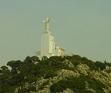
Nahr al-Kalb

The Nahr al-Kalb (Arabic: نهر الكلب, meaning Dog River) is a river in Lebanon. It runs for 31 km (19 mi) from a spring in Jeita near the Jeita Grotto to the Mediterranean Sea.
Inscriptions[edit]
The Nahr al-Kalb is the ancient Lycus River.[1] Past generals and conquerors have traditionally built monuments at the mouth of the Nahr al-Kalb, known as the Commemorative stelae of Nahr el-Kalb.
The entire site of the Nahr el-Kelb valley with the archaeological sites it conceals is classified on the indicative list of UNESCO world heritage.[2]
Geography[edit]
The river originates at a low altitude from a source that originates from the Jeita Grotto. It receives the seasonal contribution of torrents from Mount Lebanon, and almost dries up in summer.
Notes[edit]
- ^ "Commemorative stela of Nahr el-Kalb, Mount Lebanon | United Nations Educational, Scientific and Cultural Organization". www.unesco.org. Retrieved 2018-06-26.
- ^ Centre, UNESCO World Heritage. "Lebanon - UNESCO World Heritage Convention". UNESCO World Heritage Centre. Retrieved 2023-12-07.
33°57′N 35°36′E / 33.950°N 35.600°E
