
Sherlock Township, Finney County, Kansas
Sherlock Township | |
|---|---|
 Location in Finney County | |
| Coordinates: 37°57′36″N 101°01′14″W / 37.96000°N 101.02056°W | |
| Country | United States |
| State | Kansas |
| County | Finney |
| Area | |
| • Total | 162.03 sq mi (419.65 km2) |
| • Land | 161.88 sq mi (419.27 km2) |
| • Water | 0.15 sq mi (0.38 km2) 0.09% |
| Elevation | 2,953 ft (900 m) |
| Population (2000) | |
| • Total | 2,758 |
| • Density | 17/sq mi (6.6/km2) |
| GNIS feature ID | 0471607 |
Sherlock Township is a township in Finney County, in the U.S. state of Kansas. As of the 2000 census, its population was 2,758.
Geography[edit]
Sherlock Township covers an area of 162.03 square miles (419.7 km2) and contains one incorporated settlement, Holcomb. According to the USGS, it contains one cemetery, Toper.
Transportation[edit]
Sherlock Township contains one airport or landing strip, L C Land Incorporated Airport.
References[edit]
External links[edit]
Municipalities and communities of Finney County, Kansas, United States | ||
|---|---|---|
| Cities | 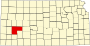 | |
| Unincorporated communities | ||
| Ghost towns | ||
| Townships | ||
| Footnotes | †This community is designated a Census-Designated Place (CDP) by the United States Census Bureau. | |
This article about a location in Finney County, Kansas is a stub. You can help Wikipedia by expanding it. |